Destinations Archives – Page 5 of 16 – Crown Cruise Vacations
S.S. Legacy is ‘green’ ship to reduce footprint on nature’s beauty
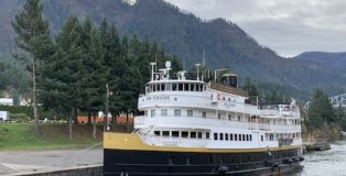
January 30, 2020 | Jackie Sheckler FinchTwo aluminum water bottles are lined up on the desk in my cabin. Cloth napkins on the dining table take the place of paper. No plastic straws. No Styrofoam or plastic cups are used on this vessel.
A daily menu is printed and attached to a frame in the dining room entryway. Daily itineraries are on a bulletin board and on a scrolling video screen so that paper use is minimized. Recycling efforts are everywhere.
Louis Armstrong: From Street Waif to Music Legend
January 16, 2020 | Jackie Sheckler FinchOn New Year’s Eve in 1912, a young New Orleans boy fired a gun into the air. That was a big mistake – or maybe it was a huge break for the child and for the world of music.
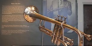
Arrested for disturbing the peace, Louis Armstrong was sent to the Colored Waif’s Home in New Orleans. While there, he met band manager Peter Davis and received his first formal music training.
Washday meal still a tradition in New Orleans
December 26, 2019 | Jackie Sheckler FinchBefore the advent of modern washing machines, many women set aside Monday for the weekly chore of washing and drying the family laundry. At the same time, they would need to plan a hearty supper.
“What they did,” said Debbie Kelly, “is cook something that wouldn’t need a lot of attention, something they could put on the stove and it would be ready at the end of the day.”
New Orleans hurricane exhibit packs powerful punch
October 1, 2018 | Jackie Sheckler Finch
By Jackie Sheckler Finch
Scrawled on well-worn blue jeans are a man’s name, social security number, blood type, wife’s name, hotel where she was evacuated for safety and the hotel phone number.
Claudio Hemb wanted to ensure that his body would be identified and his family notified if he perished in Hurricane Katrina’s floodwaters.
“Seeing all these things is horrifying,” says Margaret Thompson of Atlanta. “I saw it on the news but this museum just touches my heart and soul.”
The exhibit, “Living with Hurricanes: Katrina and Beyond” at the Louisiana State Museum in New Orleans’ French Quarter, brings home the devastating power of hurricanes. Located on Jackson Square, the museum is a popular stop for riverboat passengers when they embark or disembark for their cruises.
Hurricane Katrina in 2005 and the aftermath flooded 80 percent of New Orleans and took an estimated 1,500 lives.
“We knew right after the storm that we had to collect artifacts because we were going to do this exhibit,” says Karen Leathem, museum historian. “It was such a significant event, not only for us but for the entire state and for the nation as well.”
Although the catastrophe was precipitated by a natural event, “it was really a human-made disaster,” Karen says. “We wanted to explain why it happened and what we need to do to make sure it never happens again.”
Somber exhibits share personal tragedies
Opened in October 2010, the permanent exhibit greets visitors with a powerful emotional punch beginning with the lobby of the circa 1791 Presbytère building. Originally the residence of Capuchin monks, the Presbytère became part of the Louisiana State Museum in 1911.
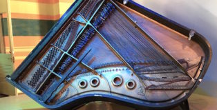
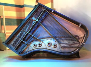
Positioned exactly as it was when floodwaters destroyed his home, a ruined Steinway baby grand piano that belonged to legendary New Orleans musician Fats Domino is a lobby centerpiece. For days after Katrina hit, people feared the rock-and-roll pioneer had died when his Lower Ninth Ward home was flooded to the roof.
A well-known homebody, Fats Domino and his wife Rosemary didn’t evacuate before the hurricane but were later rescued by boat and taken to a shelter in Baton Rouge. Almost everything the couple owned was lost. Fats Domino died Oct. 24, 2017, at age 89.
Colored stripes on the museum lobby walls depict water levels reached by the rising waters. Standing beneath the lines is a stark reminder of how people became trapped and drowned.
The ceiling is hung with hundreds of glass bottles filled with notes in homage to those who perished. Blue glass hands interspersed among the bottles honor volunteers who came to the city to help in the rescue and rebuilding.
Four galleries inside the museum contain artifacts, dramatic footage and interviews with survivors. In the first gallery, visitors learn the geographical facts about living in a city that is below sea level and surrounded by water.
Katrina’s fury felt in museum exhibits
Visitors move through an Evacuation Corridor overhearing residents’ voices weighing options as Katrina approaches. A state-of-the art Storm Theater shows Katrina’s full fury with dramatic footage of the hurricane onslaught.
Gallery Two takes visitors past a leaking floodwall and into an attic and onto the roof of a house surrounded by rising floodwaters. When his family evacuated to Houston as Katrina bore down on New Orleans, Claudio Hemb stayed behind to secure his French Quarter business.
The day after Katrina devastated the city, Claudio set out on bicycle to reach his Lakeshore home about seven miles away, inking vital info on his pants in case he didn’t make it. Fortunately, he did.
Framed in a glass shadow box is a hatchet that a mother and daughter bought two days before Katrina. Trapped in the small attic of their St. Bernard Parish home, the two used that hatchet to chop through the roof to be seen and rescued by boat.
“What would have happened if they hadn’t bought that hatchet?” asks Carolyn Miller of Louisville, Kentucky. “They couldn’t have clawed their way out of that attic without the hatchet. They probably would have died in there. It gives me shivers just to think about it.”
On the “Mabry Wall,” housing complex resident Tommie Elton Mabry wrote on his apartment walls with a black felt tip marker to record his ordeal starting with the day before Katrina hit and continuing for weeks afterward. Museum staff preserved his journal before the building was demolished.
A mud-encrusted teddy bear illustrates the personal possessions that were lost and the hope that former owners of those beloved items survived the catastrophe. A garage door shows the markings of rescuers who note that two cats and one dog were found dead inside.
“Do not remove. Owner will bury,” says a red painted message.
Disaster relief was slow in arriving
Seats from the heavily damaged Louisiana Superdome are a reminder of where an estimated 35,000 people sought refuge and rescue.
“The number of people combined with the stifling heat and the breakdown of plumbing systems created notoriously miserable conditions as the sports stadium came to symbolize failed emergency response systems,” a placard notes.
Gallery Three explains the forensics of Katrina and shows through digital animation how the levees failed. “The levees failed because of poor design and poor construction,” Karen says. An estimated 70 percent of New Orleans occupied housing was damaged by Katrina.
Gallery Four deals with recovery and promotes preparedness. “Seeing what happened here brought up discussions on how disasters are handled,” Karen says.
“Disasters happen around us all the time,” she concludes. “We need to know how to manage disasters and also what we should be looking for from our local government.”
Photo by Jackie Sheckler Finch
1. Fats Domino’s piano is displayed exactly as Katrina left it.
Shore Excursion: How Bora Bora got its name, having a cold drink at Bloody Mary’s
October 11, 2017 | Jackie Sheckler FinchIf Captain Cook hadn’t misunderstood what the French Polynesians were calling their home, the island of Bora Bora might have a different name today.
That’s a tidbit I learned from tour guide Sandra as we bounced around the popular island in our open-air “Le Truck” vehicle.
Known as “Romantic Island,” Bora Bora was originally named Pora Pora which means “First Born.” Legend says this was the first island to rise when the supreme god Taaroa fished it out of the waters.
“When Captain Cook came here, he thought the Polynesians were calling it Bora Bora,” Sandra said. “The letter ‘B’ does not exist in the Tahitian language so he mistook the softened sound of the Tahitian ‘P’ for a ‘B.’ They were really saying Pora Pora.”
Bora Bora consists of three main villages with a population of about 9,500, most of whom live on the coast. The main road skirts around the island shore line and is about 19 miles long. In the center of Bora Bora are the remnants of an extinct volcano, which has two peaks, Mount Pahia and Mount Otemanu.
Today, the Island of Bora Bora relies largely on tourism and boasts several luxurious resorts with very expensive prices. “Bora Bora was the first to build bungalows that stand over the water using stilts,” Sandra said. “These are so popular with tourists that other places started building them.”
As we bumped along the road in our tourist truck, Sandra pointed out some of the water bungalows, saying this one was where Leonardo DiCaprio stayed and that one was Marlon Brando’s until he bought his own private island.
The main languages on Bora Bora are French and Tahitian but English is also spoken in hotels, markets and other tourist locations. The pace is laid back and relaxing with the philosophy being “aita pea pea” which means “not to worry.”
We didn’t stop but drove by a ramshackle old World War II military base where the bunkers are slowly fading into the jungle. When Pearl Harbor was attacked, the U.S. military used Bora Bora as a supply base and built defenses along the coast to protect the island against a possible surprise attack by Japan.
Seven huge cannons are scattered across the landscape, quietly rusting in the island sun. Each of the guns is over 20 feet long and mounted on a swivel base.
“The military also built the coastal road on the island and Bora Bora’s first airport in 1943,” Sandra said, adding that the Motu Mute airport is still used today.
Luckily, no combat took place on Bora Bora. The U.S. military base officially closed on June 2, 1946, although it is said that some American soldiers decided to stay on the island rather than return to their homeland.
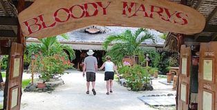
Arriving at legendary Bloody Mary’s, we were greeted by huge billboards printed with the names of celebrities, athletes, politicians and others who have visited the Bora Bora landmark. The boards were on both sides of the entrance and must have contained hundreds of names.
I’ll drop a few of them – Billy Idol, Charlie Sheen, Steven Tyler, Rod Stewart, Johnny Depp, Keanu Reeves, Janet Jackson, Goldie Hawn, Kurt Russell, James Michener, Sen. John McCain, Harrison Ford, Ringo Starr, Sean Penn, astronaut Buzz Aldrin, Diana Ross and many many more.
Established in 1979 as a small five-table restaurant, Bloody Mary’s is named for a character in James Michener’s 1946 book “Tale of the South Pacific.” The book was the basis for the musical “South Pacific” which was later made into a film in 1958 and in 2001.
The daily catch of local fisherman is a specialty on Bloody Mary’s dinner menu. Most requested drink, not surprisingly, is the spicy Bloody Mary cocktail of vodka and tomato juice served at the bar which looks like a thatched hut. Instead of a coat check, Bloody Mary’s has a shoe and sandal check. The floors are covered in sand making you feel as though you are walking on the beach.
Handcrafted tables and chairs are made of wood. One long wall of the open-air restaurant is covered with autographed and dated dollar bills plus other paper currencies from around the world. Since public transportation does not exist on Bora Bora, the restaurant offers a complimentary shuttle.
As we climbed back aboard Le Truck, the Rogers and Hammerstein song from “South Pacific” – “Some Enchanted Evening” – kept running through my mind.
This whole visit to French Polynesia has been enchanted. And it has passed so quickly.
Photo by Jackie Sheckler Finch
Shore Excursion: How ‘Holy Toledo’ got its nickname
October 4, 2017 | Jackie Sheckler FinchTOLEDO, Spain – About the closest my Aunt Minnie ever came to cursing was to mutter “Holy Toledo” whenever she had reached her “wit’s end,” another favorite Aunt Minnie saying.
I never knew what either of those meant when I was a kid. It took a trip to Toledo, Spain, to learn the origin of Aunt Minnie’s favorite exclamation.
Walking through the winding cobblestone streets, guide Almudena Cencerrado explained the expression of “Holy Toledo.” Suddenly, those words made sense.
When the capital of Spain moved from Toledo to Madrid, other wealthy families followed and donated their homes and buildings to the church for tax-exempt property. With so many church buildings, Toledo came to be known as “Holy Toledo.”
Even though I grew up in Ohio, I didn’t know about the connection between the Toledo in Ohio and the Toledo in Spain. I also learned that on my Spain visit.
“We are sister cities,” Cencerrado said, pointing to a tile sign on a building that pays tribute to Toledo, Ohio.
That also explains how the newspaper in Toledo, Ohio, got its name – the Toledo Blade.
“Toledo is well known for its swords and knives,” Cencerrado said. “The ‘Lord of the Rings’ sword was made in Toledo.”
So, when the newspaper in Toledo, Ohio, was first published on Dec. 19, 1835, it was named The Toledo Blade as a tribute to the heritage of its Spanish sister. Also, at the time the newspaper was founded, the Ohio-Michigan War was being waged for the control of Lucas County, Ohio.
It was believed, Cencerrado said, that The Toledo Blade would “always leap from its scabbard whenever the rights of individuals, or the community, shall be infringed.”
Photo by Jackie Sheckler Finch
Shore Excursion: Man in Sea Museum showcases history of diving ocean’s depths
September 13, 2017 | Jackie Sheckler FinchMore than half a century ago, four Navy divers plunged 193 feet into the Atlantic Ocean for an experiment in living under the ocean’s surface. Named Sealab 1, their “home” submerged off the coast of Bermuda was a long cylinder resembling a gigantic tin can.
“Imagine how dangerous it was and how scary it must have been for the four men,” said Michael DeGroote. “You have to remember this was five years before astronaut Neil Armstrong set foot on the moon. It was a huge event and what we learned from it was so valuable that it opened up the oceans for exploration.”
The groundbreaking experiment lasted 11 days. “The men were supposed to be down there for 21 days but there was a hurricane coming,” DeGroote said. “They could have been lost at the bottom of the ocean forever.”
Hearing about the dramatic exploits of those sailors is one thing. Standing beside Sealab 1 on the grounds of the Man in the Sea Museum in is another. How anyone could live in such a dark cramped steel container is beyond my belief. And to be anchored below the sea’s surface in these claustrophobic quarters shook me to the core.
I had driven by the museum in Panama City Beach, Florida, many times and wondered about the strange contraptions clustered outside the Florida facility. But when I stopped and went inside the Florida attraction, I discovered some fascinating history about man’s longtime quest to explore life in the ocean. Operated by the Institute of Diving, the small museum exhibits treasures recovered from sunken ships along with relics from the first days of scuba diving.
EARLY ATTEMPTS TO EXPLORE OCEAN’S DEPTHS
“I think people have always been curious about the ocean’s depth and have always tried to come up with ideas to be able to go down there,” museum guide DeGroote said, leading the way around dioramas illustrating some strange attempts to visit the ocean’s deep.
One of the earliest recorded “diving bells” was a weird metal tube inserted over a man’s body as he was lowered by rope during salvage attempts of Caligula’s pleasure galley that sank off Italy in 1531. Then there was the watertight barrel built in 1715 by English inventor John Lethbridge.
With its armholes and glass window, the barrel looked more like a torture device. However, it was successfully used to recover valuables from wrecked vessels.
“But those early divers were always hooked by some kind of line from a ship above,” he said. “Later divers relied on a line that would pump air into bulky metal helmets. It always took someone to help you get into and out of those heavy helmets and diving suits. They were so heavy that if you fell over, you would need assistance to get up.”
So the success of Sealab 1 and its successors Sealab 2 and Sealab 3 was very important to developments in exploring the earth’s waters. After being submerged on July 22, 1964, the four Navy divers on Sealab 1 – LCDR Robert Thompson, Gunners Mate First Class Lester Anderson, Chief Quartermaster Robert Barth, and Chief Hospital Corpsman Sanders Manning – spent six hours a day working on the ocean floor and gathering useful data on the body’s adaptation to the watery depths.
Living conditions at the great ocean depths were quite different than on land, DeGroote pointed out. The aquanauts had to breath a mixture of gases including helium in Sealab so they sounded like squeaky chipmunks when they talked. A Navy-produced video at the museum illustrates the physical rigors endured by the four Sealab 1 divers.
SS TARPON TRAGEDY
Among the other interesting museum displays is one honoring the SS Tarpon. “That ship has historic significance because it used to be a primary way of supplying this area with food, drink and supplies before highways were built,” DeGroote said.
Built in 1887, the Tarpon was five weeks short of her 50th birthday when she left Mobile loaded with more than 200 tons of cargo bound for Panama City on August 31, 1937. Although weather forecasters predicted calm seas, gale force winds and pounding water began battering the ship. Less than 10 miles from her destination, the Tarpon began to sink.
The crew frantically donned life jackets and tried to launch lifeboats. But it was too late as the ship lunged beneath the waves. Ship Captain W.G. Barrow was washed overboard. Survivors clung to debris in the water. As the weather cleared, crewman Adley Baker saw land in the distance and decided to swim for it. Amazingly, he staggered ashore west of Panama City after spending 25 hours in the water.
Today, the wreck of the Tarpon is a State Underwater Archaeological Preserve. Established in 1997, the preserve is an oasis of marine life and a popular dive site. The Tarpon is labeled an “Advanced-level Dive” due to depth. A laminated underwater guide is available from local dive shops to orient divers on a self-guided tour of the Tarpon preserve.
“Panama City Beach is a great place for diving,” DeGroote said. “We don’t have any natural reefs but they’ve put about 35 wrecks down there that you can dive on.”
Leaving the Man in the Sea Museum, I had a new appreciation for those long ago divers and the Sealab men who made it safer and more enjoyable to dive today.
Shore Excursion: Spanish city of Toledo and legend of the pins
September 6, 2017 | Jackie Sheckler FinchOnce upon a time, two lovers were separated by war. To pray for her soldier’s safe return, the young lady would visit an image of the Virgin Mary and pray every night.
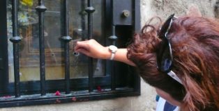
Afraid that she might fall asleep during her long vigil, the lady asked her maid to stick her with a pin if she faltered in her prayers. Then the lady would present the pin to the Virgin Mary as proof of her dedication and sacrifice.
The story had a happy ending. The soldier survived and the two lovers were reunited. In honor of the blessing that took place at this site, a narrow street in the ancient Spanish city of Toledo is now named Calle de los Alfileritos (Little Pins Street).
“Today, the legend is that if you leave a pin in the little opening here at the window with the image of the Virgin Mary and ask for a boyfriend, your prayer may be answered,” said guide Almudena Cencerrado, pushing a pin through the tiny hole.
It was easy to see that many pin wishes already resided within the spot. Safety pines, bobby pins, straight pins, hat pins and long needles were piled inside the frame. Don’t know whether the pin prayer works or not. Although Cencerrado offered me a pin, I already found the man of my dreams a couple of decades ago.
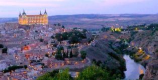
Known as “The City of Three Cultures,” Toledo is filled with legends and lore from the diverse people who have lived here.
“We are a historic symbol of peace, tolerance and cooperation between civilizations,” said Javier Diaz Herranz, tourism official. “Three cultures lived here and flourished – the Christians, the Jews and the Muslims.”
Located on a mountain top, Toledo is surrounded on three sides by the Tajo River. Declared a World Heritage Site in 1986, Toledo is a university town filled with historic sites, churches and streets so narrow that even compact automobiles can scarcely navigate them. It is a beautiful city for walking.
“Every year, more and more buildings are restored and opened to the public,” Herranz said. “Toledo was once the capital of Spain, known as the Imperial City, a city that ruled the world in that time.”
Photo by Jackie Sheckler Finch
Shore Excursion: Alcatraz now attracts voluntary visitors rather than inmates
August 23, 2017 | Jackie Sheckler FinchSAN FRANCISCO – Even on a sunny California day, the island was shrouded in fog. We were almost dead-on before the sun broke through and we could see it well.
Despite the balmy breezes, the sight gave me shivers. The island is one very scary place. And that is exactly what it was intended to be.
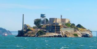
Rising from the middle of San Francisco Bay, Alcatraz Island drips with the dark atmosphere of danger and notoriety. Perhaps the most famous ex-jail in the world, Alcatraz doesn’t have its creepy reputation for nothing. From the start, Alcatraz was for the “worst of the worst.”
“If you broke the laws of society, you were sent to prison,” said guide Diane McNeely. “If you broke the laws of prison, you were sent to Alcatraz.”
Over the course of 29 years, about 1, 545 men did time in Alcatraz. Some of them never left the island alive. Eight men were murdered by fellow inmates, five committed suicide, 15 died of natural causes and seven were shot trying to escape.
“The main obsession was escape,” McNeely said. Were they successful? Yes. No. Maybe. Thirty-six prisoners were involved in various escape attempts. Whether they lived to tell the tale, in some instances, is still a mystery.
Ironically, the very place where inmates were once willing to risk their lives to escape is now a popular tourist attraction. Now, more than 1.2 million visitors can’t wait to get there every year.
Alcatraz closed as a federal penitentiary on March 21, 1963. The National Park Service became the island’s caretaker in 1972. As the last prisoner to leave Alcatraz was boarding the boat, he was quoted as remarking to a crowd of reporters and photographers, “Alcatraz was never no good for nobody.”
ISLAND NAMED FOR PELICANS
The story of Alcatraz Island begins in 1775 when it was “discovered” by the Spanish explorer Juan Miguel de Ayala. Little more than a rock inhabited by pelicans, Alcatraz was named Isla de los Alcatraces, the Spanish word for pelicans.
The rocky, barren island didn’t seem to have much value. But its location soon made it useful when the California Gold Rush hit. Strategically placed at the mouth of the San Francisco Bay, the island was the perfect site for a fort. In 1857, a citadel was constructed on Alcatraz.
However, the fort never saw combat and its defenses quickly became obsolete. In 1907, the Army decommissioned Alcatraz as a fort. But Alcatraz also was a prison almost from the very beginning. It was a military prison and the Great Depression of the 1930s made Alcatraz what it is known for today.
The gangster era was in full swing. The nation witnessed violent crime waves brought on by Prohibition and those driven by desperate need. Influential mobsters and sharply dressed public enemies exerted heavy influence. The public watched in fear.
Alcatraz seemed the ideal solution. It could condemn public enemies and serve as a very visible warning to this new brand of criminal. The old military prison was modernized. Guard towers were erected. With its natural isolating barrier created by the icy and swift currents surrounding it, Alcatraz was ready to confront the nation’s hardest criminals.
Wardens from the various penitentiaries gave their most incorrigible inmates to the Rock. Inmates with histories of unmanageable behavior, escape attempts and high public profile inmates who were receiving privileges because of their status and notoriety made up the population. Inmates arrived in San Francisco by railroad and were immediately transferred to Alcatraz.
“They never set foot in San Francisco,” McNeely said, gesturing to the railroad portal still standing where inmates arrived. “That was an important fact.”
Inmates weren’t sent to Alcatraz for rehabilitation. They were there to learn how to live by the rules. A mattress to cover the concrete bed, a blanket, a pillow, a job, a book to read, a letter to loved ones – all privileges had to be earned. And those privileges could just as easily be removed for the slightest infraction.
“You are entitled to food, clothing, shelter and medical attention. Anything else you get is a privilege,” stated Rule No. 5 in the prison handbook.
In August of 1934, Alcatraz received its first group of inmates – among them Al Capone, Doc Barker (who was the last surviving son from the famous Ma Barker Gang), George “Machine Gun” Kelly, Robert “Birdman of Alcatraz” Stroud, Floyd Hamilton (a gang member and driver for Bonnie and Clyde) and Alvin “Creepy” Karpis.
It was in Alcatraz that Capone lost his mind. Some say it was the devastating Alcatraz regimen. Others say it was syphilis, a disease he had evidently been carrying for years and from which he eventually died. Maybe it was both. “It looks like Alcatraz has got me licked,” Capone said while an inmate.
Just beyond the guarded concrete walls and barbed wire was San Francisco, a mile and a half away. Not surprisingly, 36 prisoners were involved in various attempts. Two actually made it off the island but were quickly captured. Seven inmates were shot and killed trying to escape. Two drowned and five have been unaccounted for, presumed dead.
In 1963, Alcatraz was closed. U.S. Attorney General Robert F. Kennedy said his decision to close Alcatraz was based on increasing maintenance and operating costs. Since then, the island has been left to tourists.
Lost in the fog between reality and myth, Alcatraz has become one of San Francisco’s most famous landmarks. “If these walls could talk,” our guide said, “think of the dark history these walls have witnessed.”
Photo by Jackie Sheckler Finch
Shore Excursion: Visiting historic marae on island of Huahine
August 16, 2017 | Jackie Sheckler FinchThe South Polynesian island of Huahine is said to have the best-preserved historic marae on the islands so that was the shore excursion I chose when our ship docked.
So far, the marae I have seen look like piles of rocks or elevated land. If a tour guide and info signs didn’t describe what I was seeing, I probably would not have known the historic significance of the pre-European temples.
Tour guide Georgette was fluent in English and in information. While we rode on our flower-draped bus, Georgette told us that Huahine has only one main road around the island, about 6,500 residents, eight little villages, three small hotels and the island’s economy relies mainly on agriculture, fishing and tourism.
Known as “The Garden Island,” Huahine grows abundant vanilla, melons, breadfruit and bananas. One of the least touristy Polynesian islands, Huahine has an interior that is largely undeveloped and uninhabited, leading to its reputation as being the island least changed by the modern world.
Georgette also pointed out that Huahine is actually two islands – Huahine Nui (Big Huahine) and Huahine Iti (Little Huahine) – basking in one lagoon with a bridge joining them. At one time, it is believed that Huahine was one island. Since these volcanic islands are slowly sinking into the sea, the two highest portions of the original Huahine are what show above the surface of the ocean today. Mythology claims that the two islands were created when the god Hiro cut a big island in half with his canoe.
“Before they built the bridge, we would have to go back and forth between the two islands in a canoe,” Georgette said. “We are very happy to have the bridge.”
Originally, Georgette said, Huahine was named Hermosa – Spanish for “beautiful” – by Captain James Cook in 1769. But folks called it Huahine instead because the rolling hills seem shaped like a pregnant woman lying down on her back. That sight can most clearly be seen from the air or in the island’s main town of Fare. Georgette pointed it out and I took a photo but, to me, it mostly looked like the peaks and valleys of beautiful hills.
Our stop at Maeva Archaeology Site showcased the best marae I have seen since arriving in French Polynesia. In ancient Polynesia, the open-air sanctuaries were large sacred temples where important events took place and human sacrifices sometimes made. Maraes were for worshiping gods, signing peace treaties, celebrating good harvests and performing rituals asking for victory in wars.
Before the arrival of Europeans in the 18th century, the marae were the centers for social, political and religious activity. The ancient Polynesians were polytheists, which means they believed in more than one god.
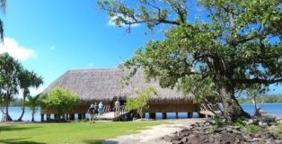
When missionaries arrived on Moorea in the 19th century, the maraes were considered pagan and destroyed or abandoned as Polynesians converted to Christianity. The Maeva marae is one of the best preserved and reconstructed, plus it has a small museum in a rebuilt chief’s meeting house constructed over the water.
To enter the museum, a polite sign asked us to remove our shoes since we would be walking on a straw mat floor. Made of wood and bamboo, the circular museum was lovely with sunshine seeping through the walls to provide natural light. The museum has some interesting displays about early Huahine life and replicas of artifacts found in the area.
Important historic finds have shown that Huahine has the oldest recorded date of human occupation among the Society Islands. Discoveries at recently uncovered sites date from A.D. 850 to 1200 and include ancient shops for the construction of canoes and assembly of fish hooks.
Photo by Jackie Sheckler Finch






View Recent Comments